Find places faster
Navigate animal zones, attractions, food tenants, and public facilities without relying only on a physical map.
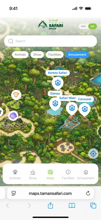
A mobile web concept for a digital visitor map experience—made to be opened in a browser while visitors explore the park.
Taman Safari Indonesia Bogor is a large destination with animal zones, attractions, food tenants, public facilities, and scheduled activities.
Visitors move between many destinations during a limited visit time. This concept explored how a mobile web map could help them find places, understand what is available, and plan where to go next.
Designed for a mobile browser, the experience keeps the map, destination details, schedules, and directions within a single on-the-go flow.
Visitors need clearer support while navigating the park.
A visitor may know what they want to see, but still need quick answers: Where is it? What can I do there? When does an activity start? How do I get there?
Help visitors find places, understand them, and plan their next stop from one mobile web map.
Navigate animal zones, attractions, food tenants, and public facilities without relying only on a physical map.
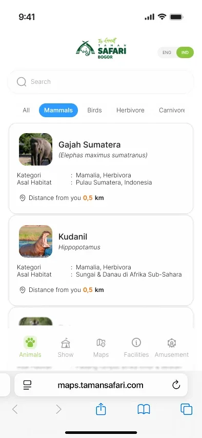
See essential information before deciding to walk there.
Check activity schedules and locations without needing to search across separate information sources.
I translated the visitor journey into four mobile web actions: explore, find, decide, and go.
I first organised park information into clear categories, then mapped the journey from discovering a destination to starting navigation on a mobile browser.
The work covered information architecture, user flow, wireframes, visual UI, and a clickable prototype.
A map experience built around finding, understanding, and reaching a destination.
 Mobile web screen
 Mobile web screen
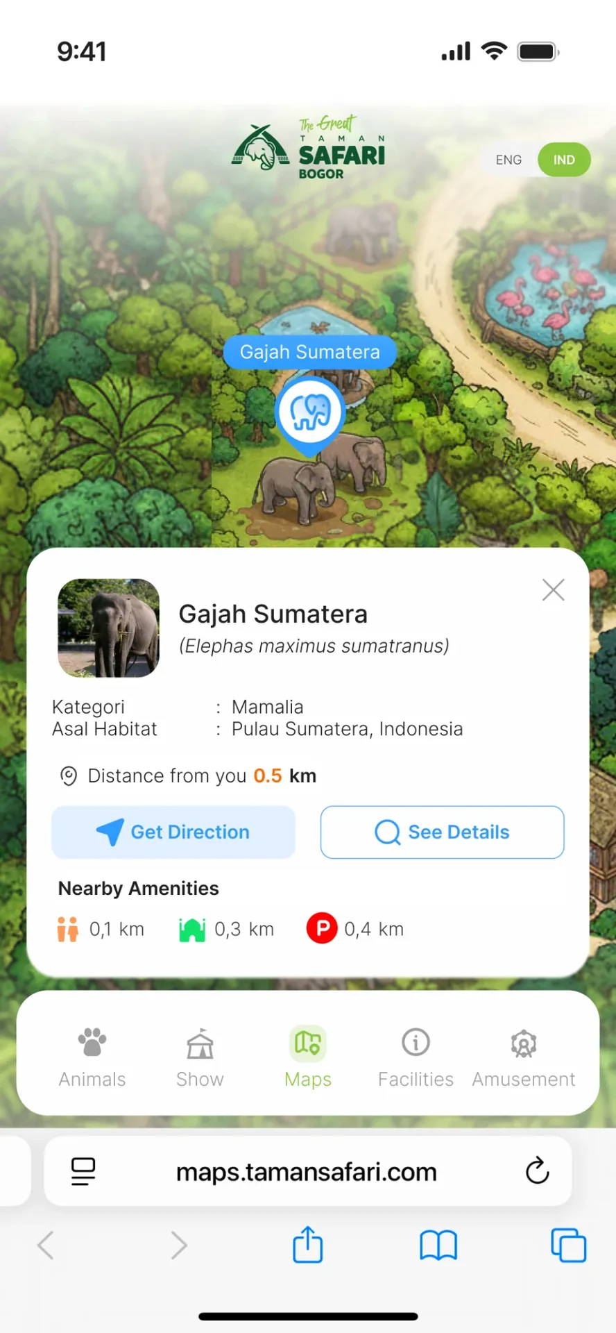 Mobile web screen
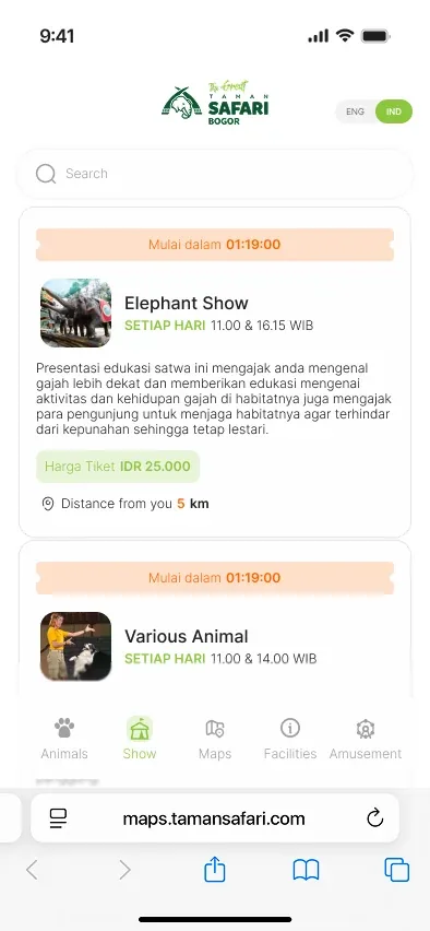 Mobile web screen
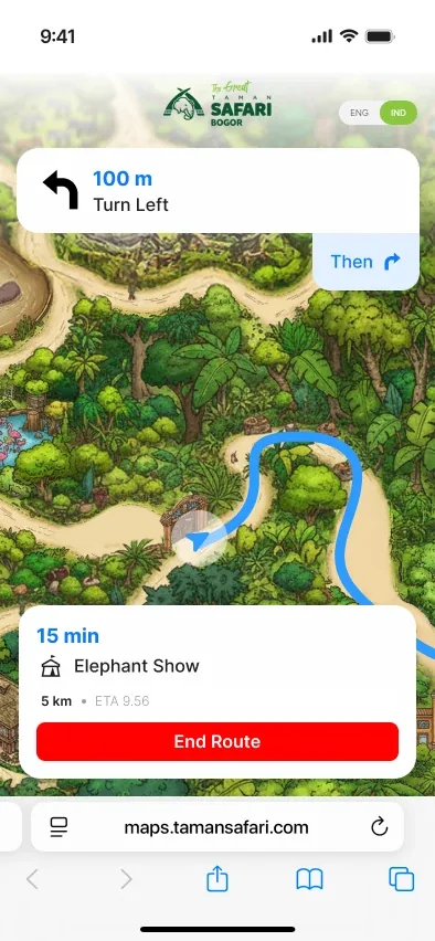 Mobile web screen
A clickable mobile web prototype for the core visitor journey.
The prototype demonstrates the mobile flow: exploring the map, searching for a destination, reviewing location details, checking activity schedules, and starting navigation.
This project was developed as an innovation concept proposal by our team and was not implemented as an official Taman Safari product.
The prototype uses publicly available information from Taman Safari’s public channels. Its map is an original illustrative interpretation created for the concept, not an operational park map.
The concept received constructive stakeholder feedback, but did not continue into project delivery.